Warmer weather is developing for Michigan in our 10-day forecast. As the heat builds, so does our threat of thunderstorms. So, we may end up being more active, but there also will be plenty of holes in precipitation, especially after Monday.
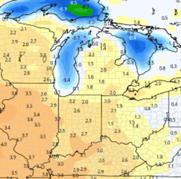
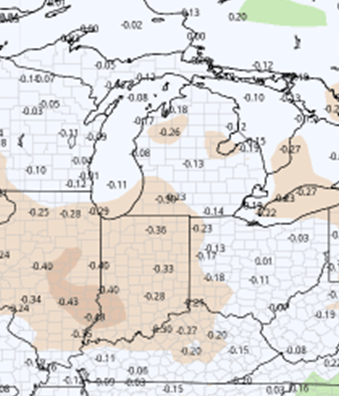
Overall, we look for the region to move into a drier than normal pattern through the end of the month at least. The biggest threats of rain for Michigan come late this weekend and Monday night into early Tuesday. The map at right shows total precipitation potential for the next 10 days, but a large part of this comes between now and Tuesday.
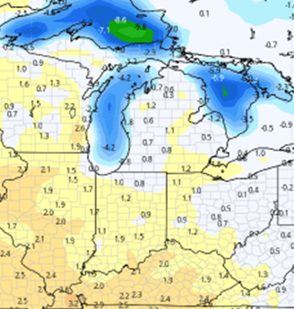
Saturday should be dry in all areas of Michigan. Clouds will likely be thickening up some over the state in advance of moisture Sunday, but generally it’s a good start to the weekend. Sunday, we have a system moving across the Great Lakes and it will have a nice spread of showers, starting overnight Saturday night, for 80% of Lower Michigan and about 40% of the Upper Peninsula. We expect scattered showers & even a thunderstorm or two, with general rain totals of 0.25”-1”
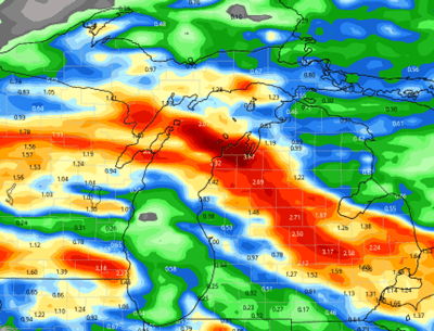
The heat starts to build on Monday as a warm front lifts into the Great Lakes. That heat creates instability with the front, and we likely see a nice outbreak of strong to severe weather over all of Michigan Monday afternoon, especially Monday night and early Tuesday morning. Rain totals can be half to 2” with coverage at 70%. Threats of severe weather will mostly be Monday night, and mostly in central to northern Michigan, but we won’t rule them out anywhere. We star to clear close to sunrise Tuesday morning.
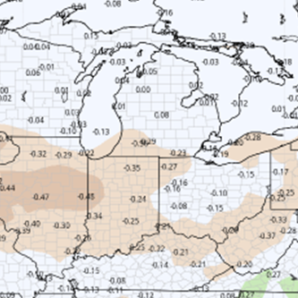
Tuesday and Wednesday will be sunny, hot and humid. Heat indices will be high, but this pattern will give us plenty of heat units. A cool front on Thursday is minor, but showers can’t be ruled out. We can see a few hundredths to 0.25” with coverage at 50%. A slight cool down will be the biggest consequence of the frontal passage. That cool down holds for one day…on Friday.
Heat and dryness return for next weekend on into the following Monday.
Extended Period:
A minor front on Tuesday, June 21 may bring a few hundredths to a few tenths but will break the heat cycle a bit. The rest of the extended period stays sunny and dry on through Monday, June 27. That pattern, if it holds, will dry the region down very quickly.

Weeks 3 & 4:
We are below normal on precipitation in both weeks, and normal to above normal on temperatures. Crop stresses are likely in the period.
Week 3 Precipitation (Green = above normal, Brown = below)
Week 3 Temperatures (yellow/orange = above normal, blue = below)
Week 4 Precipitation (Green = above normal, Brown = below)
Week 4 Temperatures (yellow/orange = above normal, blue = below)