Sunny warm and dry for the entire weekend over the IN-MI area. Temps remain well above normal and evaporation rates strong. We will be watching a significant front try to develop to the west over WI and MN for Sunday, but that moisture really only has a shot at working into the UP, and on Monday perhaps a few northern tier counties of MI. So, the majority of crop producing areas will continue to have a wide-open harvest window.
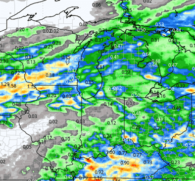
The frontal complex slides southeast through Monday night. Scattered showers first work Through MI, and then Indiana through Tuesday. We end up with 80% coverage or better in both states with rain totals from .25”-1”. There can be some embedded thunderstorms, but those will be rather isolated. The map at right shows our look at this event at this point.
![]()
We swing back to dry weather very quickly at midweek. Sunshine dominates Wednesday and Thursday with clouds increasing Friday from north to south, first over MI, and then through northern Indiana. This is ahead of another minor frontal complex that approaches to kick off the weekend. However, its coming pretty fast. Most of the moisture associated with it falls from sunset Friday through sunrise Saturday. Rain potential looks to be .1”-.5” in MI, and then .1”-.75” over a large part of Indiana. The rest of the week should be on the drier side.
We start the week of the 13th with a bit of instability around. We wont rule out scattered showers on any given day, Monday through Wednesday (15th). No more than 30-40% coverage on any individual day, and we end up with 3-day coverage at 80% in MI and 30% in Indiana. The Indiana potential stays mostly north of US S24 and not dramatic. Moisture totals are not overly impressive at half an inch or less in Indiana and up to .8” in MI.
Extended Period:
A solid cold front sweeps through the region Friday the 17th, bringing equal chances of rain to all parts of the Great Lakes region. Rain potential will be .25”-.75” with 80% coverage. There can be some stronger winds with this frontal passage. Behind it we cool a bit, but no major drop in temps. Dry air returns behind the front as well, holding into the week of the 20th.
Weeks 3 & 4:
Our fall pattern we’ve seen the past few weeks continues into weeks 3 and 4…above normal temps and on the drier side for precipitation.
Week 3 Precipitation: 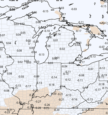
Week 3 Temperature: 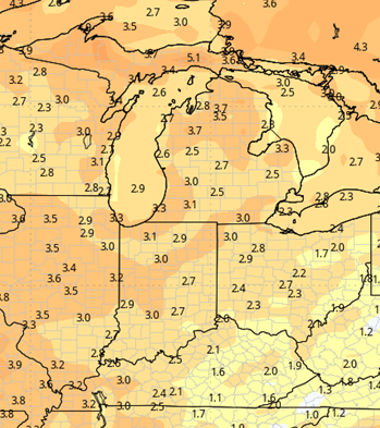
Week 4 Precipitation: 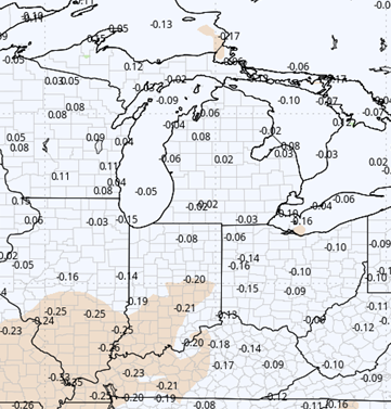
Week 4 Temperature: 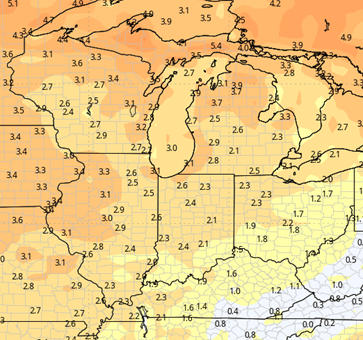
Chief Meterologist Ryan Martin’s Harvest Weather Forecast is brought to you by M and W Seeds.