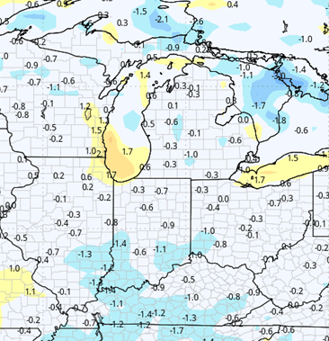
After a damp weekend, we should put together a much drier outlook for a large part of the Eastern Corn Belt. Over the weekend we do see a little bit of moisture trying to work through. A system that kicked off Friday night will be moving out to the east fairly quickly Saturday morning to midday. That system will end up giving most of Indiana .1”-.75” of an inch and the majority of MI the same. However, in far SE MI, thunderstorms will boost the totals significantly. A second wave is going to try and develop for early Sunday morning to midday. We can see another few hundreds to half an inch mostly over the northern half of IN. Farther north in Michigan, that second wave is mostly non-existent, with the exception being far southern tier counties, mostly along the US-12 corridor and southward. There we can see a few hundreds to a tenth or two as well Sunday morning to midday. The map at right shows precipitation over the region through midnight Sunday night.
![]()
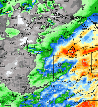
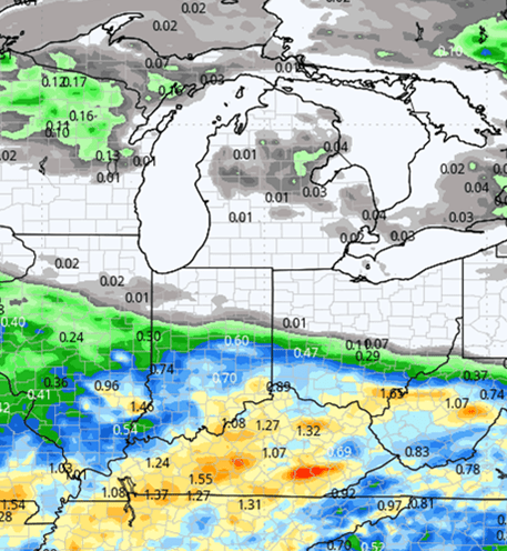
All parts of the region are dry for Memorial Day on Monday. Dominant sunshine is expected with high pressure over Michigan and northern Indiana. We continue to see that fuel s drier Memorial Day in southern Indiana as well, but it will not be a direct impact…more just keeping inclement weather at bay. Tuesday and Wednesday of next week, we do see a significant split in the weather pattern. We stay dry from I-70 north in Indiana all the way up through Michigan. But I-70 southward, we will feel the pressure of moisture that lifting up from the Deep South. That moisture comes out of the lower Mississippi River Valley, Tennessee Valley and Deep South in general for Tuesday and Wednesday. While we are definitely seeing the “multi-inch” totals stay well south, we have to allow for anywhere from a tenth or two on the low end to maybe half an inch or more south of I-70 for the two days combined with coverage at close to 60%. Thursday of next week forward right on through June 5th we have a large scale upper level Ridge holding over Michigan, Indiana and the eastern corn belt in general. That should give all parts of the region dominant sunshine, high evaporation rates and excellent dry down. We should see most of the region be able to get in and finish planting and field work in that stretch. There may be a little bit of a delay on the heaviest soils that can’t go till late that period. However, most places should be able to see substantial field work activity and opportunity. The maps below show precipitation potential for Monday through Wednesday (left) and then Thursday forward through June 5th (right).
Extended Period:
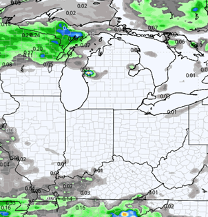
We see a little bit more instability trying to work into the region past June 5th. However, we do not see it yielding a large batch of precipitation right away mostly due to the fact that the previous dry pattern has robbed the atmosphere of available moisture. However, we do expect a few hit and miss showers late the 5th and then bigger rounds of rain and thunderstorms for the 6th. Rain potential can be up to .75” to finish off the dry pattern that preceded it.
Weeks 3 & 4:
Weeks 3 and 4 go back to normal to above normal precipitation to help with newly planted crops. Temps will be near to below normal for Indiana, but mostly a bit above normal for Michigan in week 3, near normal in week 4.
Week 3 Precipitation: 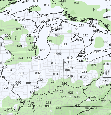
Week 3 Temperature: 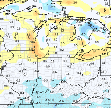
Week 4 Precipitation: 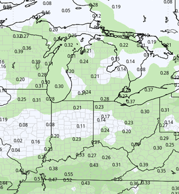
Week 4 Temperature: